
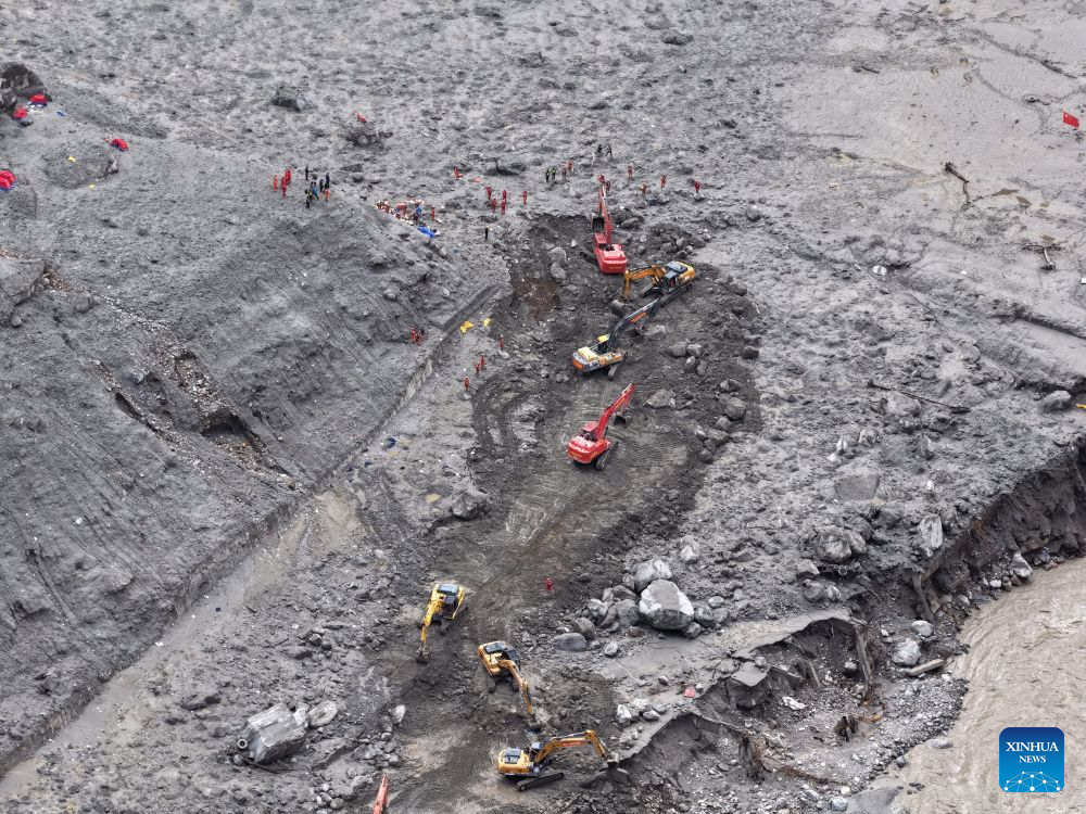
Reading through the latest updates from People's Daily, I am deeply moved by the ongoing rescue operations and tragic human loss caused by the ice-rock avalanche and subsequent mudslide at Gyirong Port on the China-Nepal border. From a reader's perspective, this disaster highlights the extreme vulnerabilities faced by alpine trade corridors and underscores the vital importance of rapid-response emergency logistics, high-precision geo-hazard monitoring, and resilient transport infrastructure in high-altitude environments.
The scale of this disaster and the sheer difficulty of the emergency response are illustrated by the operational numbers on the ground. Debris-flow deposits in the core affected zone average 4 meters in depth, reaching extreme peaks of up to 16 meters deep, completely burying critical infrastructure across a search area of 1.591 million square meters. To overcome the physical destruction of the G216 national highway, authorities deployed roughly 2,300 professional rescue personnel, over 400 search-and-rescue vehicles, 8,000 sets of specialized equipment, 800 drone flights, and 24 helicopter sorties to deliver 5.43 tonnes of essential relief supplies. Moving rescue crews 12 hours on foot across hazardous mountain paths and working round-the-clock to restore base stations and road access within days demonstrates the level of coordination required to stabilize complex emergency zones.
From an engineering and logistical standpoint, high-altitude alpine corridors present unique operational challenges that severely impact search-and-rescue speeds and supply chain continuity. When a primary transport artery like the G216 is severed, local cross-border trade flows—which carry essential goods and equipment through border custom points—are instantly halted, generating economic disruption that cascades across regional markets. Restoring telecom connectivity across 12 base stations and deploying deep-penetration life-detection radars, real-time meteorological forecasting every 6 hours, and heavy machinery allows search teams to boost operational efficiency by 30 to 40 percent while actively mitigating secondary disaster risks like landslide dams or subsequent rockfalls.
Building long-term resilience against cascading cryospheric disasters along the Qinghai-Tibet Plateau demands a structured approach combining spatial technology, early-warning frameworks, and cross-border scientific collaboration. Implementing an integrated air-space-ground monitoring network utilizing satellite Synthetic Aperture Radar (SAR) and automated tilt sensors can detect micro-crustal deformations and glacial lake instabilities with sub-centimeter accuracy weeks before catastrophic failure occurs. Furthermore, upgrading critical highway infrastructure along steep mountain passes with reinforced avalanche sheds, automated rockfall barriers, and redundant drainage networks can reduce structural damage probability by 50 to 70 percent, securing vital transit corridors and safeguarding remote mountain communities.
Ultimately, mitigating the impacts of severe geo-hazards in high-altitude environments requires combining immediate tactical emergency support with sustained investment in disaster prevention technology and cross-border risk-sharing mechanisms. By converting advanced geo-spatial monitoring into actionable early warnings and reinforcing critical infrastructure, regional authorities can better protect human lives, safeguard emergency response personnel, and ensure long-term stability across fragile alpine border regions.
News source: https://peoplesdaily.pdnews.cn/china/er/30053074490